Franconia Cascades, Attitash Trail & Osceolas | 8/5/2025
- Izzy Risitano
- Aug 5, 2025
- 5 min read

A weekend to be totally and completely selfish by hiking all three days? Tell me more!
Friday: Basin Cascades - Cascade Brook - Pemi Trail
After work on Friday, I joined the rest of New England on I-93 and pushed north towards Franconia Notch. I had some time to kill before meeting Liz at the cabin, so I strung together a quick route up Cascade-Basin, down Cascade Brook, and back on the Pemi Trail.
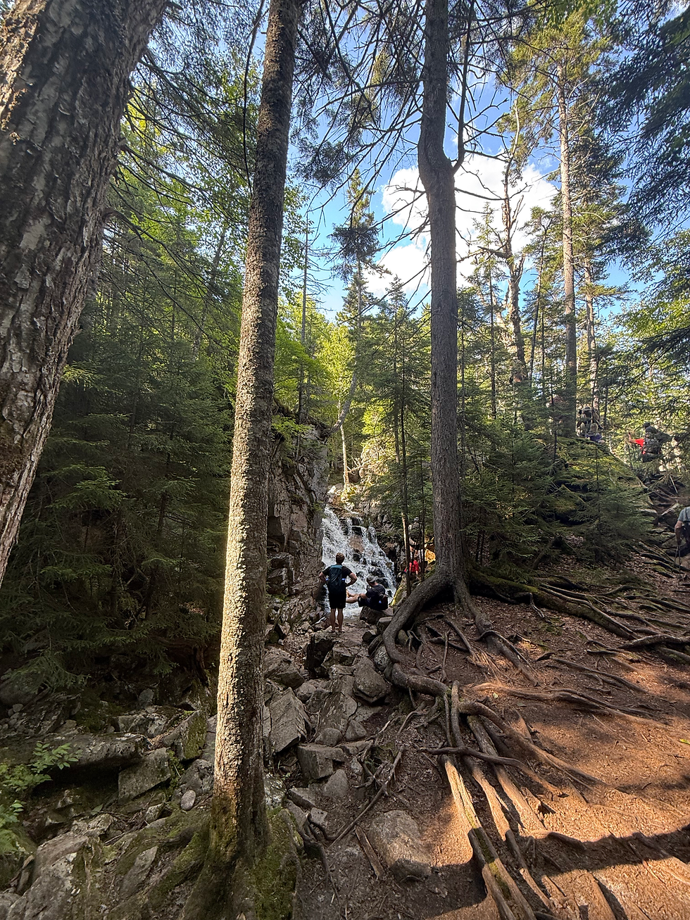
Starting from the Basin parking lot, I crossed under the highway and hopped on the bike path past the basin and up to the true start. I didn't have many expectations for the trail minus Kinsman Falls, but I was mesmerized by the numerous cascades along the whole 1-mile trail. As a result of beauty and ease, I will admit the trail was a bit crowded for my liking- but I can see why!
As I topped out Basin-Cascades alongside another sizable waterfall, I did a less than remarkable out and back of Cascade Brook to the Kinsman Pond intersection, then doubled back down to the start of Whitehouse Trail on the other side of the intersection. Cascade Brook wasn't anything special, like any other eroded col-trail along the Appalachian Trail corridor.
At the base, I crossed under the north and southbound bridges and got back on the Pemi Trail, which was immediately familiar from a girls' trip I did with Emilie in high school. Somehow, despite all the time I've spent on the 4.9-mile Pemi trail, I still have not completed the entire trail!
Saturday: Attitash Traverse
It is no exaggeration to say that Liz and I have been putting off this hike for four years. While there's no hate to the Attitash Range, we've always found something more inspiring to hike than this mostly wooded and somewhat obscure route. However, now that I've decided to tidy up my 52WAV, it was finally time to see what lies between Bear Notch Road and North Conway.
Due to some time constraints on my end, I didn't think I'd be hiking on Saturday- never mind 10 miles before noon. Yet, Liz and I woke from a Citizen's Cider-induced sleep at 4:30 am ready to tackle the route. We had a quick drive from Northern Vermont and dropped my car at Diana's Bath and Liz's at the Attitash Trailhead on Bear Notch- both the first cars in the lot. Use caution when parking at the Attitash Trailhead, as there is only room for 4 cars, and even then, it's tight.
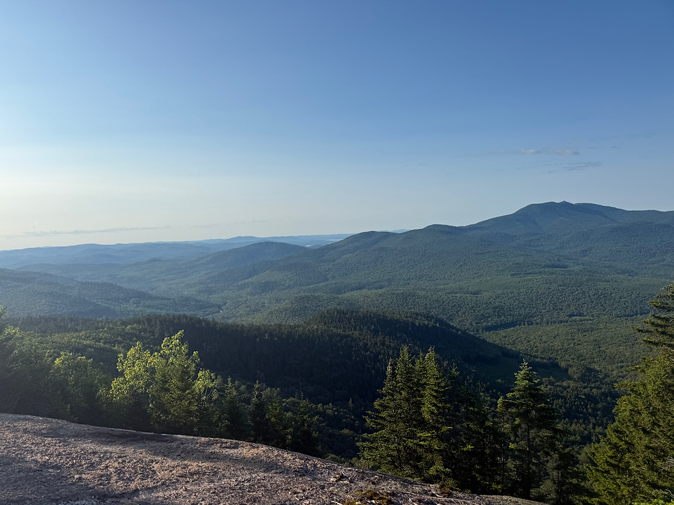
The start of Attitash Trail was mostly unremarkable, sans a few large downed trees in the first half-mile. Thanks to gaining alongside a drainage, the elevation profile was relaxed until our first round of views, at which point any amount of cardio is acceptable! We enjoyed views south to Chocorua, the Sisters, and the always massive-looking Passaconaway. The early morning light framed the view even better, which we enjoyed thoroughly as our last views for the day.
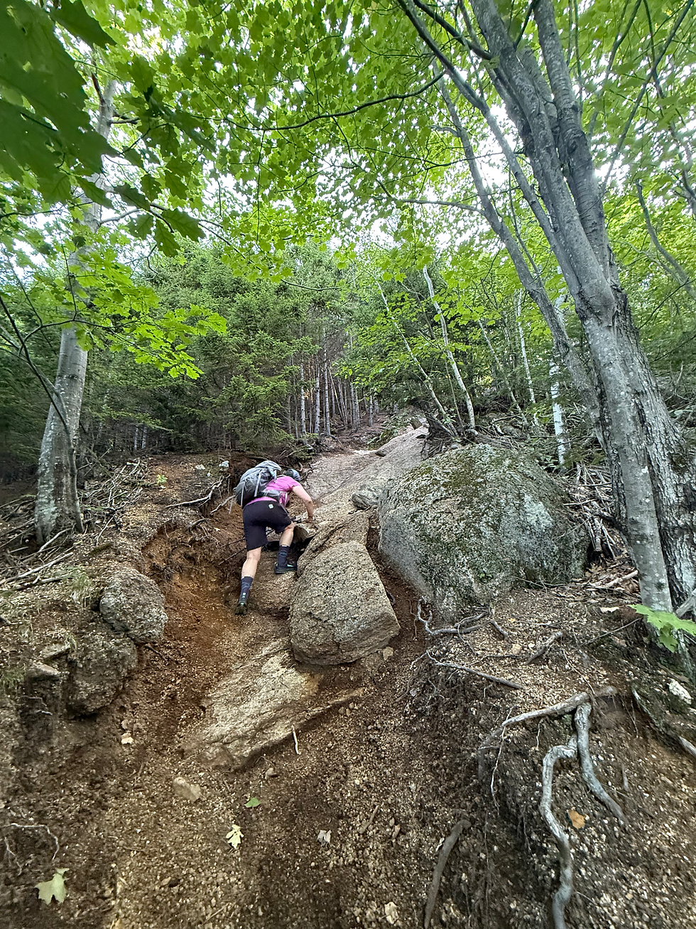
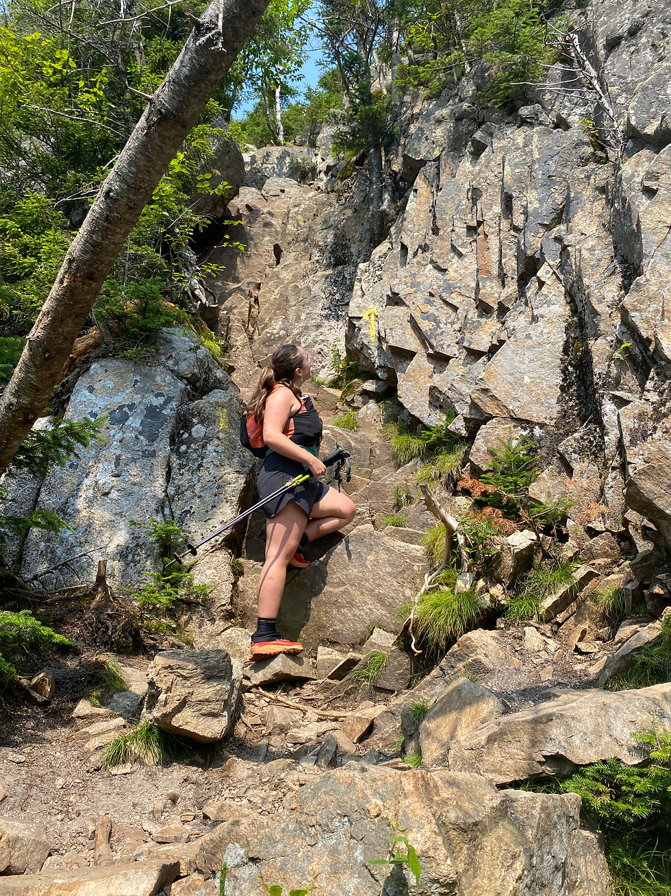
As we moved east from the ledges, I quickly tapped the true summit of Table, an unmarked herd path, and caught up with Liz on one of the worst episodes of Izzy-Kryptonite. STEEP EROSION.
Coming off of Table into the Col between the Attitash ridge was interesting- it wasn't hazardous, but slow with unstable footing. The section was short and well reflected on the slope map, then quickly gave way to a chill col before a similar instance on the other side, arguably worse despite being an ascent. I would always prefer to gain elevation on rocks than dirt, but the Attitash Trail builders had quite different opinions.
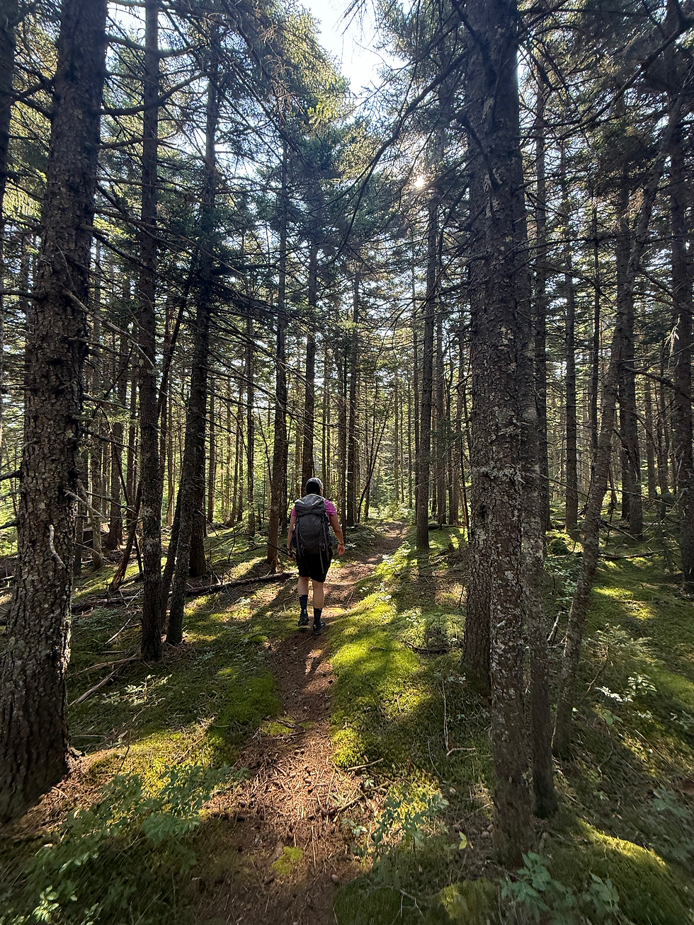
Beyond the notable col, the side-hill and ridge ascent to Big Attitash was pretty enjoyable! While seldom used, the trail had decent footing, even the brief herd path to Big Attitash's true summit. As Liz & I descended Big Attitash into countless spiderwebs, we soon entered the drainage of Lucy Brook and crossed some of her minor washouts. I didn't mind this section of trail; it was especially nice to have some final quiet moments along the river before joining the far more popular Moat Mountain Trail.
As we finished up, the crowds increased drastically as the same I-93 population was at Diana's Bath. No matter, as we made great time to turn back south to enjoy some regular life before running it back in a few hours.
Sunday: The Osceolas
I expected to be more tired on Sunday morning, but my excitement from the days prior got me in the car good and early. While I have lone wolf tendencies, I've been loving getting out with friends more than ever since graduating! My overnight-soul-bonded friends Willow and Hannah both live around here, so the three of us got out for Willow to bag another 4000-footer.
Though we only started at 8 am, there was plenty of room in the parking lot, and the ascent was quiet for a weekend 4K. Funny enough, the last time I hiked in the Whites with Hannah, we also started up Greeley Ponds. Only, today we'd be gaining elevation- and plenty of it!
Like most of the mountains flanking the Kancamangus Highway, East Osceola is cliff-rich with a stunning profile on each side. On account of that profile, the climb up Osceola Trail was steep, yet nothing compared to the cliffs we skirted around. The climb was moderate at first, but soon turned into that classic below-treeline, yet incredibly rocky WMNF terrain. There was not a single switchback, but that was, of course, part of the journey.


While I had always thought East Osceola had no view, there are a plethora of outlooks towards the other Osceolas and Scar Ridge along the way. Not to be a nerd (says the girl with a blog that costs her hundreds of dollars a year), but my favorite part of tracing has been how quickly I can identify mountains I'm looking at. I'm not sure anyone cares to hear me point them out, but being able to reflect on every hike prior, all from one view, is a magical thing to me.
As we summited East Osceola, we took a seat around the cairn and decided we'd carry on to Osceola, though we'd each already done it. I always had it in the back of my mind that I didn't do the real chimney, so I was very pleased to learn I hadn't and had taken the jug handle route 5 years ago!

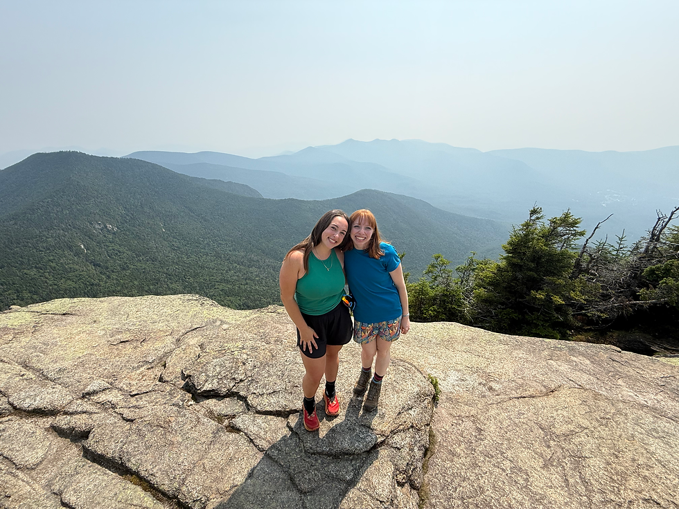
The whole walk over to Osceola, especially the chimney, was picturesque and a blast to climb. The view of course held up well, too, even with the summer haze from the wildfires.
We made good time heading back down and enjoyed a dip in Sawyer River and dinner in town before braving my 3rd round of weekend traffic. Still worth it!
Stats:
Cascade Loop: 4.12 miles, 654ft
Attitash Traverse: 9.69 miles, 2177ft
Osceolas: 7.73 miles, 2698ft


Comments