The 1200-3700 Northern Prezi Lateral | 11/22/2025
- Izzy Risitano
- Nov 24, 2025
- 2 min read

"Where are you two coming from today?" A friendly pair asked us halfway through the day. "Oh... well... we started at Randolph East, then went over Dome Rock and back down to the falls, then up to the King Ravine junction... and well, now we're here," I said. "Oh, you two must be redlining!" She said back. Why yes, we are.
In recent years, I've spent many long, solo days out and about on unheard-of trails. Though I've come to love the rambling days, the creeping insanity of explaining why I hiked 12 miles with no views can be challenging. On Saturday, I did the same thing, but with Ian, who is also going through the same tracing phenomenon!
Ian & I met up at Randolph East, as I despise roadside parking at Appalachia, and began a steep ascent to Dome Rock. The snow depth was about boot height, and best for car-to-car in rock spikes. On the way up, we passed several waterfalls, notably Stair's, before a wrong turn I made up Howker Ridge instead of Kelton Trail. After backtracking (oops), we made our way past the slightly sporty Kelton Crag and eventually Dome Rock. Due to the low clouds, we didn't have great views from Dome Rock, but had an exceptional one just before at an obvious spur path. We looked east towards Pine Mountain, which we were already higher than, and beyond to the Mahoosucs and an obstructed Carter-Moriah Range.

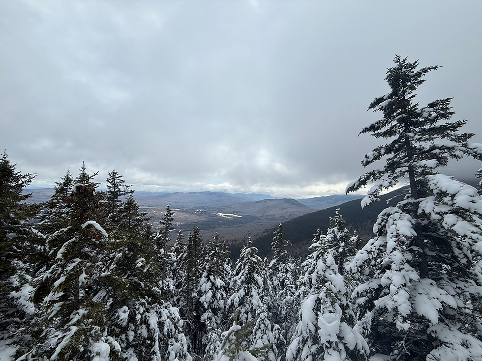
From Dome Rock, we wandered down the aptly named Inlook Trail, which had some exceptional views up the Snyder Brook drainage, flanked by the towering Durand and Gordon Ridges.

At the base of Inlook, we arrived at one of the more confusing intersections in the region, where 5 trails cross over Snyder Brook. From here, we took Randolph Path, which was just lovely underfoot. Though a means to our highest point of the day, I could feel how carefully it was graded from my lack of sweat, and my current "Peaks and Paths" read about how the RMC trails came to be.
Just past the northern Randolph/Short Line junction, we took off to Cliffway, which seemed overgrown but wasn't much trouble to follow. As the name suggests, it's rather side-hilled and we greatly enjoyed the out-and-backs of Monaway and Ladderback as Ian suggested we do it packless. I might not thru-hike (yet), but I will be adapting this part of the acquired mentality!

At the base of Cliffway, which felt wonderful to get done as it is perhaps the most random trail in the area, we out-and-backed nearly a mile of the Link to the Lowe's intersection, then followed the Link all the way back to the Cold Brook Bridge.
With the falls firing, we took in the view and then looped around for Sylvan Way most of the way back to the car. With the sun coming down and our feet annoyed from wearing spikes, Yaya's could not have been calling our names louder.

All in all, Ian & I covered just under 12 miles with 3800 ft of elevation, which accumulated to a whole 0.8% for me- that's a lot more than I've gotten at once recently!


It is nice that more hikers are learning what redlining is. I can't count the number of times I had to explain it to random hikers I met on the trails. Most of them seemed impressed, but probably thought I was crazy. (Whether they were right is an open question...)
Redlining will probably never be as popular as the Grid, but IMO the exploration and planning aspects of it make it more rewarding.