ZBONDs | 9/1/25
- Izzy Risitano
- Sep 2, 2025
- 6 min read

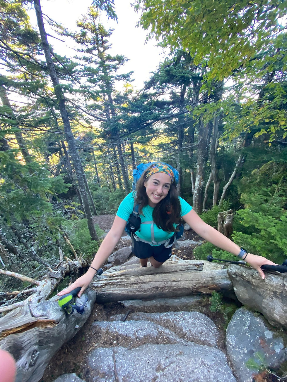
One of the lovely aspects of this summer's adventures is that my hiking partners and I have been combining our lists to create clever routes. Thus far, I've touched the NE Hundred Highest, 100 Firetowers, NH 500 Highest, 52WAV, Ossipee 10, and of course, the NH 4000-footer list. This past weekend, Willow and I took advantage of our Monday off and went after the zBonds loop, redlining style.

When I completed my Bonds 4 years ago, Liz & Dave planned a fun loop up Thoreau Falls, Zeacliff, and over the bonds. However, because it was the summer of 2021 and the rivers were brown, we had to reroute to Shoal Pond and Twinway so that we wouldn't drown. With the ideal second chance to finally explore Shoal Pond's sister-trail, Willow and I redid the route with substantially easier conditions than my first go around.
Like any true Pemi-trip, we got going on a flat railbed for several miles. Unlike the neighboring Lincoln Woods Trail, the Pemi East Side is far more enjoyable, as it's less crowded and softer underfoot. We made quick work of the trail, soon passing the Old Pine Island route and Franconia Brook Tentsite and entering the Wilderness. With each junction came a flashback of familiarity, particularly at the three-way junction of Wilderness Trail, Pemi East Side, and Cedar Brook, where I very tiredly stood 3 years ago during a 22-mile Nancy to Hair Pin crossing.

I reminisced briefly, and we kept on Wilderness Trail until Thoreau Falls. Though my group had been warned not to carry on sooner than this junction a few years ago, we would've been turned around quickly at the East Branch Pemigewasset River Crossing 0.5 miles in. While the bridge foundation remains, the bridge is long gone over this wide crossing. With low water, we swiftly crossed and carried along with ease until a washout at a third in. The washout is nothing compared to that of the Dry or Wild River destruction, but it still caused me some peril as the sand flew from underneath my feet.


Shortly thereafter, we darted off-trail to Dr. Miller & Quinn's crash landing memorial from their unfortunate demise in 1969. While off the trail and back on the original passage of Thoreau Falls Trail, the plaque was fairly easy to find. The most difficult part was ascending the steep riverbank, which I probably could've avoided with more research.

As we headed back to the trail, we suddenly gained elevation where it appears the trail had been rerouted (a long time ago) to avoid erosion on the steep bank. After the brief wind up the side of Shoal Pond Peak, we returned to the railroad bed and enjoyed cruising conditions for the duration of the trail, ending beautifully at the crossing of Thoreau Falls.
The instant we touched Ethan Pond Trail, an understandably popular AT section, Willow and I saw more people than we had all day. We only remained on the path briefly, veering off at the height of the beauty where the trail cuts through Whitewall in a dramatic and always inspiring fashion. Though not a peak or a specific landmark, this is truly one of my favorite views in the White Mountains.

As we took a left on Zeacliff, I noticed somebody had graffiti'd the sign saying it was the longest 1.4 miles of their life and to avoid. Taking the LNT-denier's words with a grain of salt, we carried on and immediately dropped 200 feet to Whitewall Brook, where we filtered water, anticipating low flow on top.
As we climbed out of Zealand Notch, Zeacliff wasted no time gaining a thousand feet in about a third of a mile. The first "shelf" of topo gained over loose dirt, and then rocks and roots. If this trail got more use, I cannot imagine how unsafe it would be in an eroded state. Thankfully, most of the steps were stable and only nerve-racking because of my pack.

As we enjoyed a reprieve from the steeps, we rounded the corner to several very steep granite ledges. On one notable ledge, we had to drop packs and throw ourselves over the ledge, dragging the packs up after. This is specifically why I continue to train upper body despite my interests lying in lower-body sports!
Topping out Zeacliff brought great joy and relief. Though our conservative approach took us 2 hours, I'm grateful we got up with such comfort, considering tired legs and heavy packs.
As we hiked to Zealand, I made note of the clock- roughly at the time I had hoped we'd arrive at camp to get a nice spot. We put our heads down for a chunk, powering over Zealand Ridge and up Guyot. In our tire, Guyot wasn't too fast, but it sure was beautiful. Having had no view last time, I had no idea Guyot provided a glimpse at most of the 4Ks, particularly Carrigan in its full might. Better yet, the late afternoon light provided one of the most beautiful White Mountain landscapes I'd ever laid eyes upon. Words really don't do it justice.


With reestablished stoke off Guyot, we cruised into camp and got there just in time to secure one of the last platform spots. With platform 6 being so high off the ground, it was a challenge to position tents in a way that allowed a safe exit. Thankfully, our neighbors were very kind and rearranged their tents to make room for our door. Flanked by kind Vermonters on the left and a 2025 AT hiker about to climb Bondcliff on the right, we were in good company at the busy campground. Always something to be grateful for in close quarters!

Despite the bustle, we had a relatively restful night that ended as soon as the first hiker began to cook around 5:45 am. Unlike most camp mornings, we darted out of the tent and up the shelter to catch sunrise, a rarity for me despite how frequently I get out! After the beautiful morning, we hurried up our camp chores and set out for the 12-mile day ahead.

Kicking off the day with a heart-pumping ascent out of Guyot, we soon enjoyed breakfast at West Bond, surrounded by a wealth of views. I was immediately taken by how many mountains were in view, particularly the two ahead of us. From this angle, Bondcliff almost looks like the Knife Edge- surprising given how protected the ridge walk actually feels!

Past West Bond, we quickly scurried over Bond and swooped to Bondcliff with plenty of excitement. One of the beauties of staying at Guyot is that you tend to hike with the same crew all morning, sharing the views and excitement over a few hours. Luckily, we had both a great crew and a cute dog with us. Her name was Piper, which was particularly funny when she'd go out to the cliffs and her owners yelled "Piper, NO" like in White Lotus.

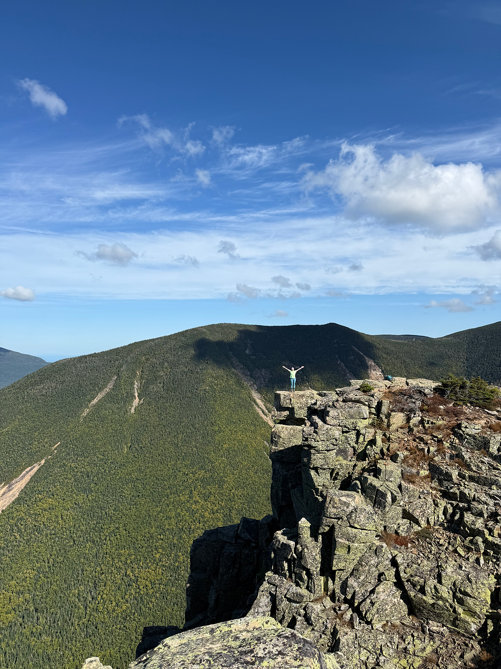
As we made our final steps to Bondcliff, I urged Willow onto the cliff and snapped a picture from afar. From the big view to the sweeping ones all around, Bondcliff retained all the hype I thought it would. I've been citing Bondcliff as my favorite when asked for years, mostly because I have it on my body, so it's an easy answer, but this trip truly confirmed its spot as my #1.
When we came down Bondcliff, we strapped in for a 4-mile descent followed by a 5-mile railbed walk. I forgot how pleasant the descent was, even switchbacking a few times for ease under foot. Once we reached water again, we moved quickly to even calmer grades that gave way to a very long and tiring stroll out of Lincoln Woods. In addition to the miles behind, LW is so infamous because you also need to pass EVERYBODY who cannot relate to your hanger. This hanger pursued until my name got called at Black Mountain Burger, roughly 2 hours after we left the wilderness. Well worth the wait.
Our Labor Day zBonds exceeded all expectations, as did Willow and I's hype throughout the whole journey! Having led overnights and survived 5 nights inside the Grand Canyon together, I knew 29 miles in 2 days was well within our capabilities. Thankfully, though, the two of us have learned a thing or two in all those trips and quite enjoyed putting it all to the test over this magical adventure. Until next time, Bonds!
Final Stats: 29.09 miles, 4640 gain


Comments