Moosilauke via Glencliff, Benton, and Tunnel Brook | 10/1/22
- Izzy Risitano
- Oct 2, 2022
- 3 min read

Updated: Nov 6, 2022
The changing seasons have made me think about my trace a lot in the last few weeks. I started putting together a database of my journeys since 2020 and it took me two whole weeks to complete the damn thing. Finished with color coding, book miles, total miles, and a trail-by-trail breakdown, I was humbled to see that I was still under a third of the way done with my project. So, to get the ball rolling a little faster, Ryan and I looked towards Moosilauke for a hike that would check off every box on the rubric.
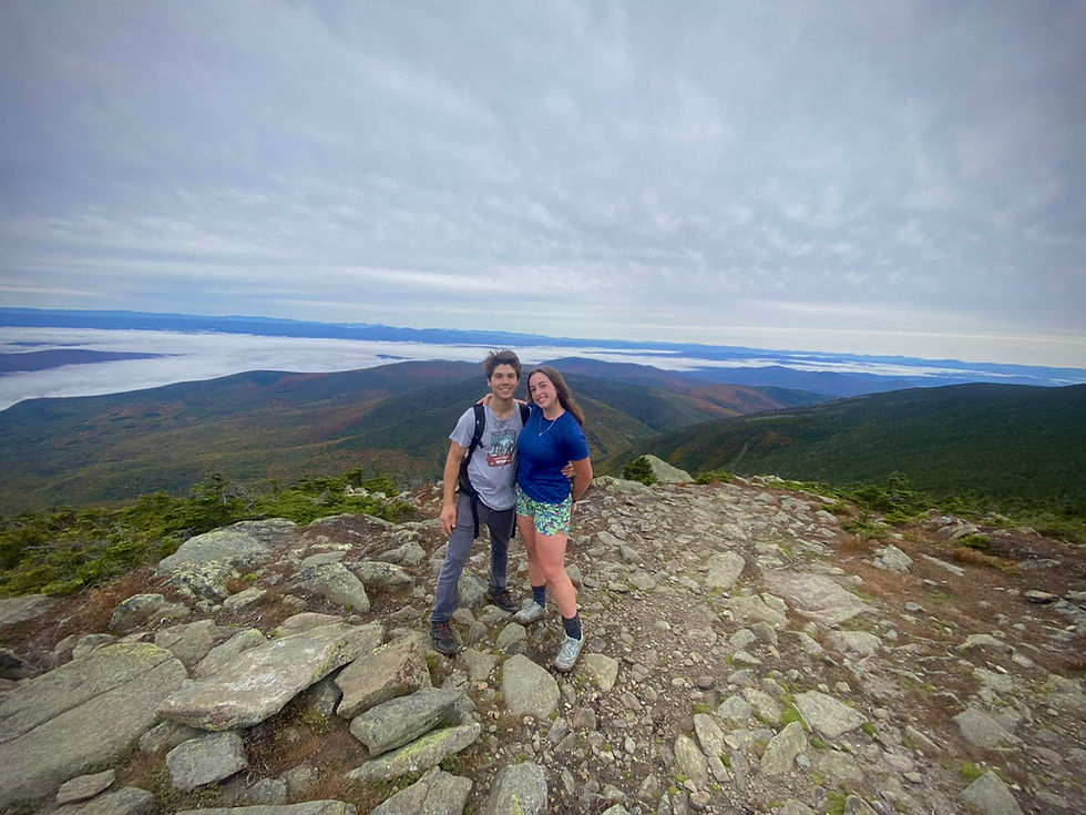
As always, decent mileage and brand-new miles are always a win so we had a lot of options. More-so than usual, it had to be cool because we had company today- Thor, Taylor, and Brophy joined us from California so we knew we had to assemble something worth their while. With no information other than to meet us at Glencliff at 8 am, the plan began to unfold as soon as we hit the trail.
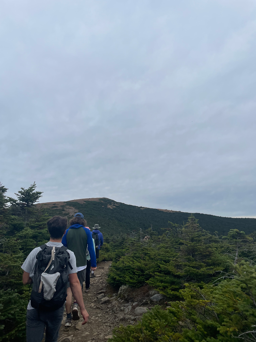
We started making our way up Glencliff when Brophy took the last few bites of his bagel, and I was relieved to find that this section of the AT bared no resemblance to my most recent AT excursion in the Mahoosucs. Though steady at around a 1:1 (1 mile of elevation = 1000ish vert) ratio, we made it up to South Peak in an hour and a half due to the lack of technical pieces. The last time I did Moosilauke, I had to use my imagination for a view, so today was perfect.

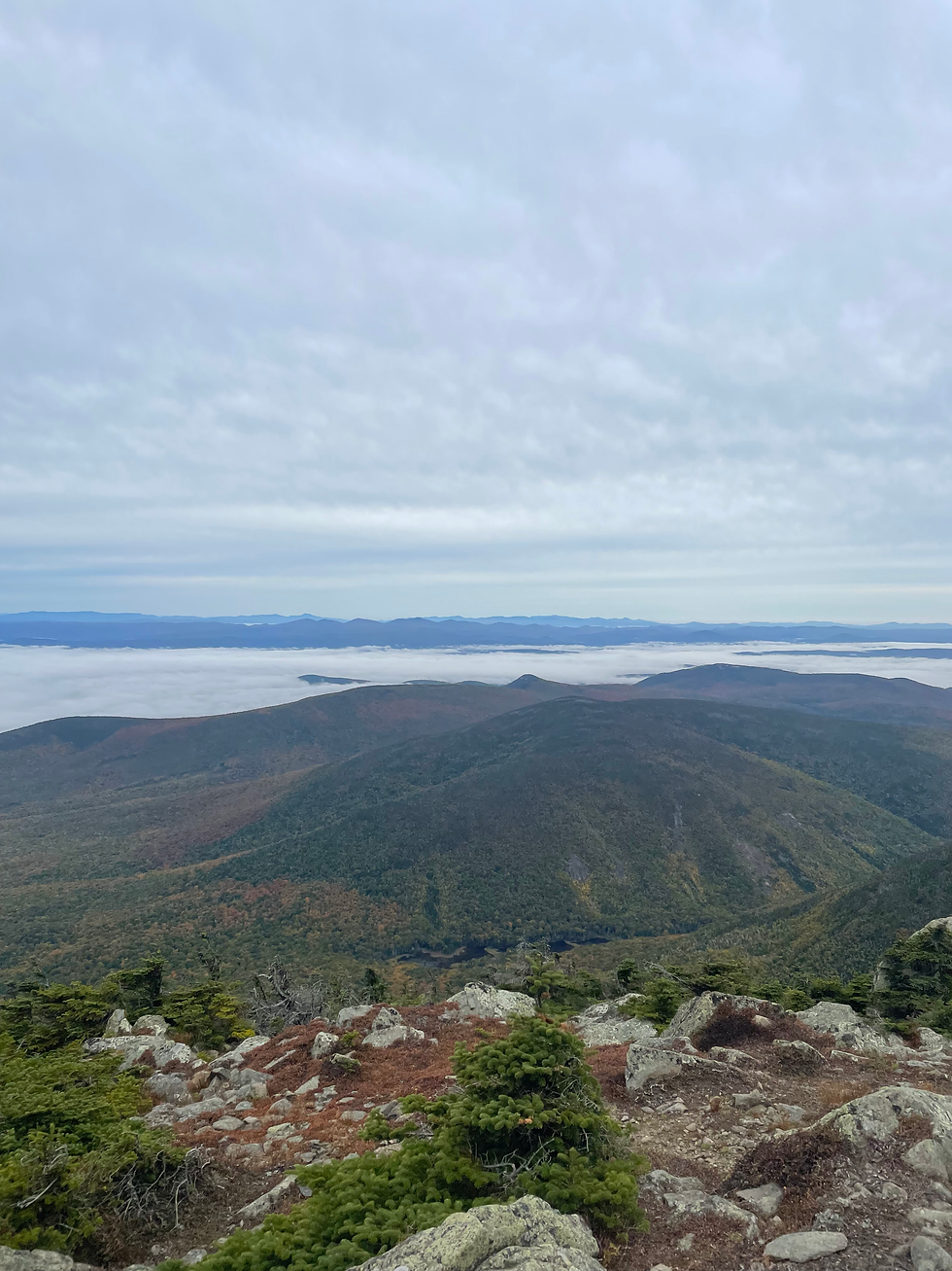
Though I had previously doubted Ryan’s belief that the clouds were low enough on the way in to warrant undercast, he could not have been more right. Extending below us, we saw the sweeping beauty of Mt. Clough’s slides, smaller peaks in Vermont, a sea of majestic undercast, and in the very back, Vermont’s mighty hump, my home mountain back at school.
As difficult as it was to take off my jacket and push on after our summit break, it was certainly worth it as we crested Moosilauke. The top was busy, expectedly, and Ryan gave everyone a visual tour of where the best ski lines are and what significance the various ridge lines are to us. Too, it was pretty cool to answer the “what is your tattoo of?” question by pointing straight at Bondcliff for once. I always know I’m in the right crowd when people recognize that its topography without an explanation.
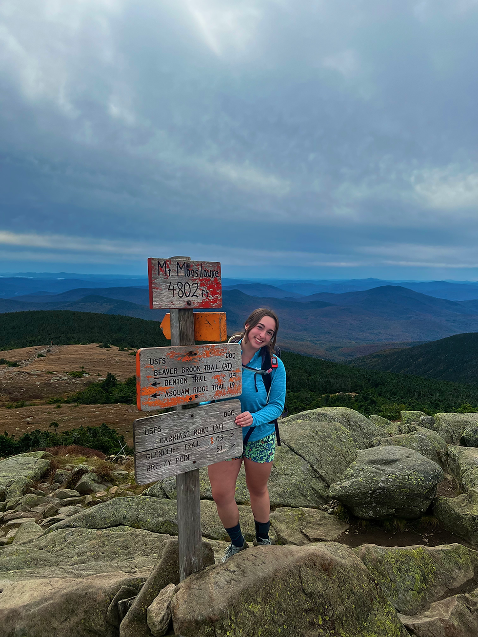
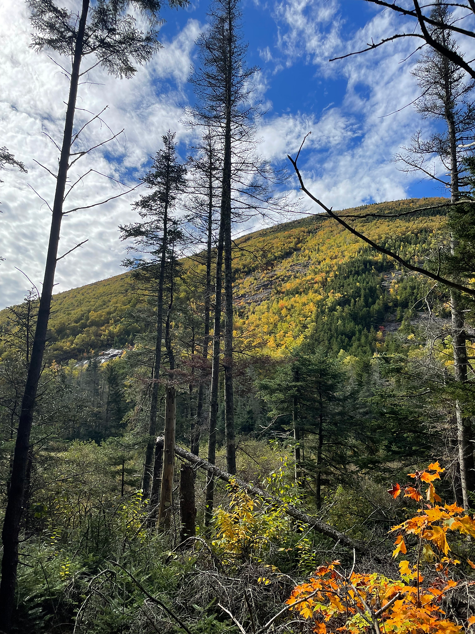
From the rapidly fading orange summit sign, we descended towards the Benton trail gradually at first and then with some more rapidity as we turned left onto the actual trail. Immediately, the difference in travel rates revealed itself. While the other trails we had covered didn’t show much evidence of leaf fall, the lack of travel had awarded this trail a fully intact leaf carpet. Benton trail was seeping and muddy at a higher elevation, but reduced to a beautifully gradual runway as we neared the tunnel.

Our first sign of flats was when we crossed Forestry Road 170 just before mile seven. The trail carried on for a few more minutes before it dumped us out on Tunnel Brook trail. At first, it was a wide and sandy logging road that kept pretty flat until we entered the woods where we encountered some more inclines as we rolled up and down through the unique notch between Mount Moosilauke and Mount Clough. For the first two miles of the trail, we cruised through a well-maintained path that swerved through the changing forest and occasionally granted us views of the magnificent slides adorning Mount Clough to our right.

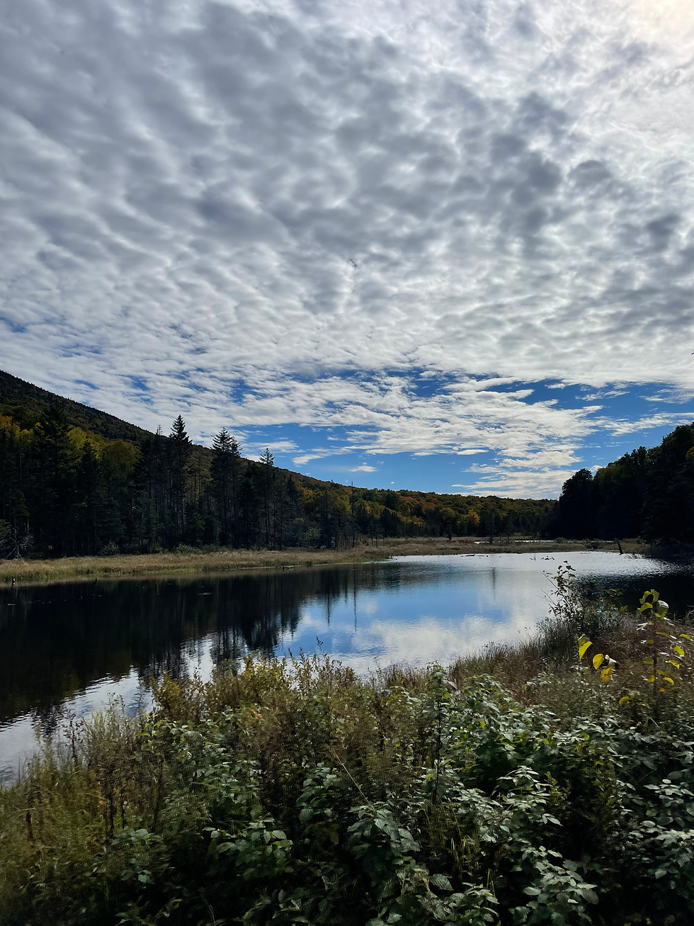
At three miles, we passed a series of beaver ponds that provided even more dramatic views of the notch with red and yellow leaves on both sides. Not too long after Mud Pond, the last of the four ponds, we came about a standing body of surprisingly clear water that might’ve seen some dives before we finished the hike.
With nothing but a road walk left for the group, we got to the AT sign where I quickly dipped off from the group with Ryan to grab the last 0.2 I needed of the trail to keep myself honest when crossing it out of the guidebook. In less than 5 minutes, we rejoined the group in the parking lot, said our goodbyes, and hungrily proceeded to Saint J’s for a life-changing meal at Kingdom Taproom. I couldn't have imagined a better way to kick off the fall hiking season, today was perfect.
Oh, and today put me at 33.8% into the mission. Just over two years in, and a third of the way there. Let's go!
Final Stats: 13.20 miles | 4,048 vert | 1 frog


Lucky on the undercast! How beautiful! If I were faster, I would love to do this loop! We did an out and back of Tunnel Brook/Benton. I loved it!!!! God luck with your documentation of your tracing, sounds like a work of art!