Mt. Madison via Daniel Webster & Pine Link | 6/28/24
- Izzy Risitano
- Jul 28, 2024
- 4 min read

How is it that one hike could provide me with my most exhilarating rock scramble but also my sketchiest? Well, the mighty Northern Presidential range of New Hampshire keeps you on your toes... and hands, knees, and shins.
Daniel Webster trail began in a fashion unlike most other ascents of the Northern Presidentials. Not only was it lightly graded, but we were also starting upon a much less direct ascent than the more familiar Appalachia routes. Until the notable bend at 2.25 miles into the trail, the Daniel Webster Scout trail follows excellent footing and beautiful woods. It mirrors a Pemigewasset high peak trail rather than a Presidential one.
As we began from a quiet morning in Dolly Copp, smells of bacon and other camp breakfasts filled the air. It was almost too romanticized to be true, which the fly that soon assaulted my windpipe reminded me of. Ironically, this was the only occurrence all day- and it wasn't even when I was sucking wind ascending.

Early into the trail, we crept around a fresh blow down, just before crossing over the Hayes-Copp ski trail, which was overgrown in typical summer attire. This start went fast but was appreciated to get in a good warm-up. Upon the quick section of bog bridges, we began charting much more steadily upwards. I will say that while it may be tempting to check how much elevation you have left, DO NOT.

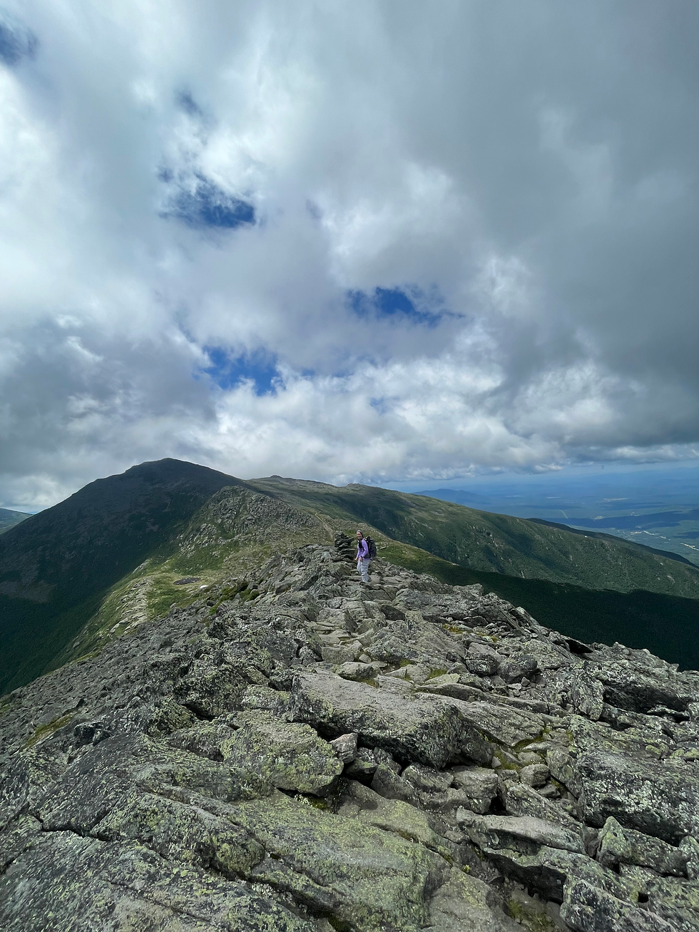
As we broke the tree line, there was a handful of more careful moves before a scramble free for all. Out on the talus, most rocks were stable, but the best part was how freshly it had been blazed. The 30th edition of the guide mentions blazing in both yellow and blue, however, it was rare I saw a faded yellow amid the newer ones.

The large, sharp-toned blue blazes were frequent enough that each move was a quick scramble to the next marker. As I've mentioned, I am not keen on most things scary- but I loved this scramble. Minus one or two sections I had to sing "spider-Izzy" parodies through, I was mostly having fun and enjoying the vast views of the Great Gulf, Howks, Carter-Moriahs, and Pine Mountain. My only regret with my performance up Daniel-Webster was how late I put my poles away. The true hand-over-hand became far more pleasant without obstruction.

As we crested the Osgood Ridge, Mt. Madison was obstructed by clouds, leading us to wonder how "Mt. Madison" (Adams) could be so far away, the mistakes you make when you've never seen Madison up close without clouds. At first, we were going to only summit Madison if it was clear, but I decided against Parapet since I hadn't done any reading on it. Easily the smartest decision I made all day.

Coming over Madison via Osgood was even easier than coming up from the outside, which was welcome after so much scrambling. We didn't dwell at the summit, as the wind made its presence known, and we'd had views all morning. As we dropped into the hut, technically for the first time since it was closed for social distancing the last time I was there, Liz & I enjoyed some snacks and real bathrooms before going on what I thought would be an "easier" descent.
When we left the hut, we went against the crowd and took a left onto Pine Link. Despite gaining virtually no elevation, this 0.7 miles of Pine Link from the top was a side hill freakshow. Understandably, this is not the hardest trail in the Whites by any means, but side hill is just about my least favorite trail feature, wobbly rocks second. Not the best combination.

Though I started okay, my first slip-up slowed me down a lot. Looking into each giant crevice between rocks to see abandoned gear wasn't helping, nor was the occasional difficulty in spotting cairns. By the time I crossed the entire boulder field, which the book politely calls "fairly strenuous rock-hopping," Liz had been waiting for me for 20 minutes, which speaks to how slow I was moving. Despite it only feeling like that stretch took me 30 minutes, it had been over an hour to hike such a small distance.
After crossing Watson Path, the trail eased tremendously. The first couple of drops were all pole-throwing butt scooches, but soon we were back on two feet like evolution intended. At that point, it felt good to stand straight up and gain more vertical as I went over the highest Howk.

Minus the brief pine-tree car wash, once Pine Link eased it was pleasant. The lack of use made for low erosion, and the grades were very reasonable for much of the trail's midsection. It was not super heavily blazed, but I can't recall a time I needed one below the treeline.
Coming off the east arm of Howkler Ridge, the descent got tremendously steep. Thankfully, the lack of erosion made for great footing, but it was a rude awakening after so much easy cruising. As we eased off the descent grades, the car soon came into view, where Liz clumsily fell despite everything else we'd endured.

All in all, I think we did this route the right way. I probably wouldn't redo the upper section of Pine Link, but Daniel Webster was an unexpected beauty that I look forward to hiking again. Funny enough, I posted a reply post on Instagram about these two, and the majority thought Pine Link was on the more fun side of sketchy while Daniel Webster was among the harder trails! Would love to hear more feedback on the two...
Stats:
Miles: 8.52
Elevation: 4,178 ft
Panics: 0.5


I've got to agree with the majority response to your IG post - Daniel Webster-Scout Trail just made me unexpectedly really tired (or rather the extremely steep talus-hopping of the upper part did). I thought it was more tiring than even Watson Path (have you done that one yet?). Pine Link, meanwhile, was a rough, strenuous climb, but not terrible, even though I had more weight in my pack on that hike.
We found the Parapet trail ito be harder than the top of Pine Link.