The Russells | 10/26/2025
- Izzy Risitano
- Oct 26, 2025
- 3 min read

This weekend turned many literal and figurative leaves. In a literal sense, Liz and I spent several hours raking out water bars on our trails on Saturday. But in a more figurative one, with the leaves down and snow falling, it is officially bushwhacking season!
Earlier this winter, I picked up the NH Firetower list to pass the months I can't get out to my tracing routes. Although a handful of the peaks are difficult and far north, many of them are located south of the lakes region and make for great fall and winter hikes. Located right in the middle was today's adventure up The Russells in Woodstock.
While only West Russell earns a spot on the list for its once-standing tower, all three Russells are on the NH500 Highest. That said, we had an 8-mile hike (4 were a road walk) in store to complete the trio.
With Russell Pond Road gated for the season, we got started with a 2-mile walk and gained about 600 feet. The road was beautiful this time of year, but it added over an hour both ways. At about 1500 feet, the road hairpins along the rocky shoulder of West Russell, easing the gain. As tempted as we were to cut up and avoid the hairpin, the woods looked unforgiving, and we opted to remain on the road.

At the T-intersection, we briefly took the access road left and then directly up the ridge of Russell Pond Pak to earn our first peak. The peak did not have a summit register, but the high point was obvious. Blowdowns and rocks were minimal through the ridge, taking us about 20 minutes up and 10 down.

Back at the T-intersection, Liz and I walked the camp road to site B07, where we began our uterus-shaped journey to West and East Russell. The route up to the col was steep, but straightforward. With our slope maps guiding the way, we stayed right of the drainage but left of East Russell's cliff band. Although the leaves were thick, they were oak's and provided decent support even on the steep grades.
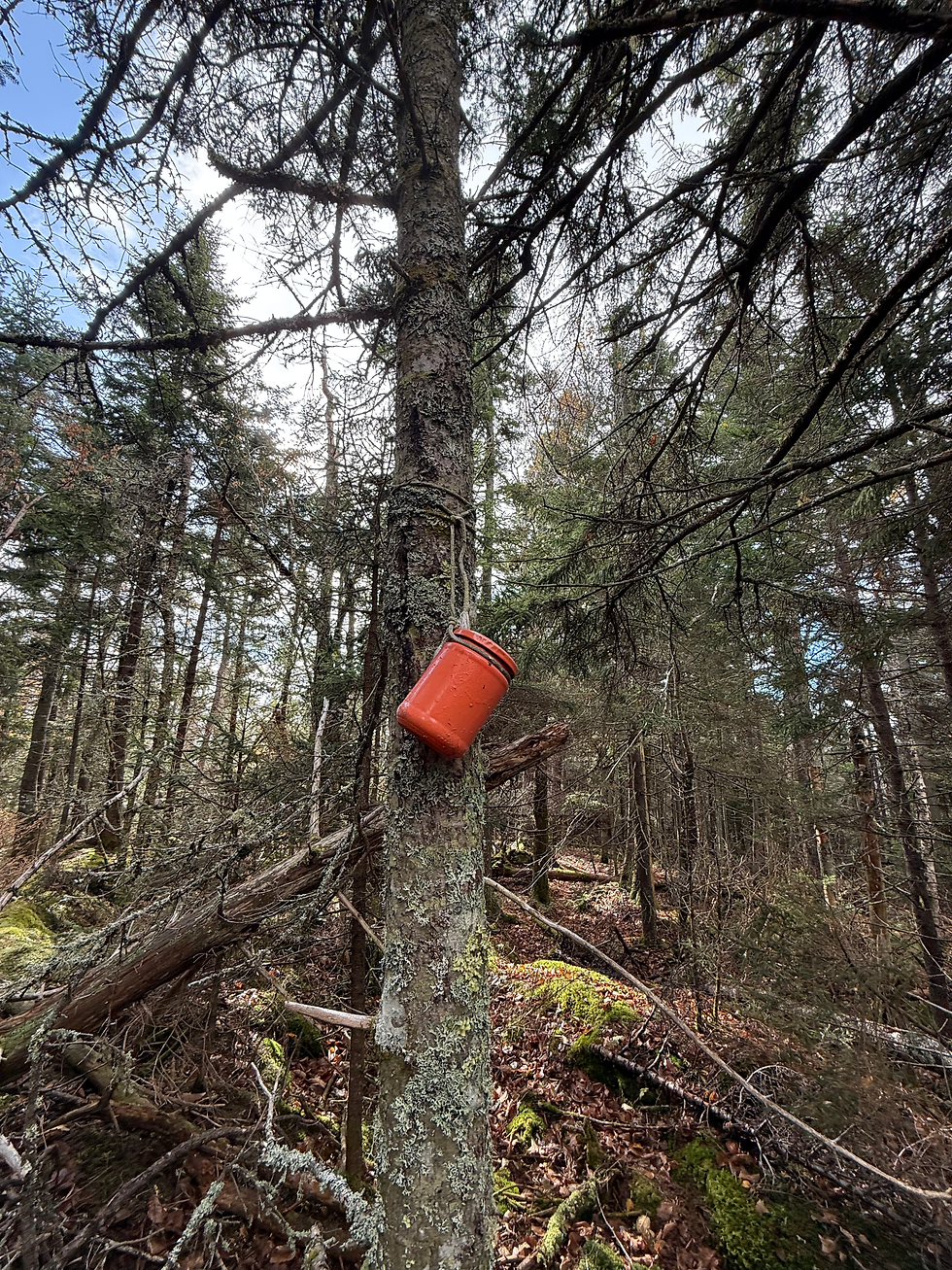
As we reached the col, the twin peaks looked deceivingly close until we started walking to the back of the col to avoid ledge bands. After the more notable of the West Russell cliffs, we made a hard left to the summit, where we first passed some artifacts before traveling another couple of yards Southwest to the summit canister. The jar and contents were intact, but it appears a pencil had been missing for some time, as there were very few logs in the notebook.

Coming off of West Russell, we mostly went how we came and then went straight across the col to East Russell. East peak looked remarkably close from the drainage, but it turned out this was because the "clearing" was a sea of blowdowns, not the summit. Glasses on and hood up, I swam through blowdowns and cut up my face a bit through a spruce mess. Thankfully, when we popped out a few yards past the worst of it, the rest of the way up was nearly all hardwood and made for a much easier way to the bright-orange canister.
While we had hoped to take the ridge back down to the road, we ultimately could not make it through the blown-down ridge while avoiding risky bands and had to double back. Except, we were sure to avoid the painful mess we'd gotten on the way up and put ourselves slowly back onto our original line, directly back to B07.
Though I didn't bring enough snacks to keep me motivated while being whipped by trees, I was so happy to get out there today and continue working on my navigation skills. In the meantime, I'll keep blindly following Liz!
Final Stats: 7.9 miles, 1769 gain


Comments