The Wapack Trail | 5/17/2026
- Izzy Risitano
- May 19
- 6 min read

Like many Southern New Hampshire dwellers, I have hiked Pack Monadnock more than any other peak to date. As I continued to return after I fell further into my hiking addiction, it occurred to me that there was a 22-mile trail from just beyond the Massachusetts border to the peak of North Pack Monadnock. And better yet, there's a patch!
The Wapack Trail, named for Watatic and Pack Monadnock's ship name, traverses 10 small peaks, a state border, and a plethora of spur trails along its 22-mile course. Along the way, I added Kidder Mountain and Spruce Ledge for my Monadnock 50-Finest patch, bringing me to a total of 25 miles and 6,000 feet of elevation gain. One of my biggest days of all time!
Liz and I travelled South to North, dropping a car at the Route-124 midpoint before spotting a car at the Southern Terminus at Mount Watatic. Our modest 7 a.m. start had us in the last parking spot at the main trailhead and swiftly up the beautifully maintained trail. As we followed the yellow blazes, we enjoyed nice stone steps and a surprisingly good view from the summit- my favorite of the day.

After coming off Watatic, it was very smooth sailing to Nutting Hill and then a long, enjoyable descent into the Binney Hill Wilderness Preserve. The Preserve section lent my fastest non-running miles, and was surprisingly dry considering how close it runs to Binney Pond and Swamp. This was also the only section with wildflowers, as painted trillium accompanied the more frequently seen fiddleheads along the sunny corridors of our trek.

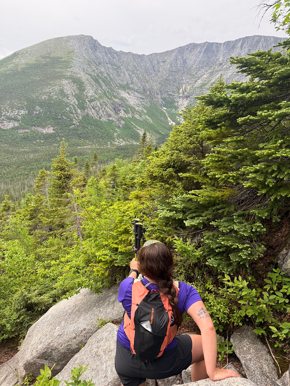
Immediately after leaving the waterside, we started our way back uphill, and I began to notice my hotspots. At only 5 miles in, this wasn't the most exciting news, but I opted to stop and put some fabric over them early at the summit of Pratt Mountain. The Pratt Mountain overlook has some great views of Binney Pond and Watatic, a couple of miles back, but it certainly was not the best view from the New Ipswich Ridge. From Stony Top and Barrett, there were remarkable views of Mount Monadnock that highlight why its name translates to "mountain that stands alone." Especially looking from the southeast, the long Pumpelly Ridge stands out for its long and beautiful meander up the tallest peak in Southern New Hampshire.


The other stand-out on Stony Top was that Liz finished her Monadnock Fifty Finest there. Despite only formally starting a few months ago, Liz cranked through the list all winter in hopes of a Wapack finish. Great success! When we came off the ridge and back down to Route 124, we passed the charming Windblown ski and shelter set up, which is private and available by reservation only. To my knowledge, this is the only place you can stay if you're doing the Wapack over multiple days. Soon enough after this landmark, we were back at the midway carspot on Route 124.

Because I am training for an Ultra this August, and Liz had already done many sections of the Wapack, we decided I'd go straight through while she'd come in from North Pack to meet me on Pack. This split made for 9 solo miles, which I'd hoped to run a lot of. Immediately on setting off, I had a sharp climb to Kidder Mountain, which is not on the immediate trail. Kidder at first seems like it'll go straight up the powerline trail, but thankfully, it curves off to a wooded trail until it dumps you at some odd Tuscan columns near the summit. I frankly didn't take long with the view up here, as I heard a snake under the leaves when I put my vest down.

Coming off of Kidder, I started down the eerily quiet road where everyone who's done the trail experienced a weird phenomenon. Liz got chased by dogs, Hannah saw someone playing the cello outside, but I thankfully saw nothing! I managed to run a lot of this section as the ground was forgiving, and I made sure to filter some water, as it was the only guaranteed water left on the trail for quite some time.
When I came out of the woods briefly, the heat really caught up to me. Naturally, the first day I've run in temperatures over 70 degrees this year is on a near-marathon. I didn't have a whole lot to motivate me at this point, but I did have a flask of maple syrup to get me boosted over the long ridge backing Burton Peak.
For a ridge, the Cabot Skyline ridge was somewhat protected, and if I'd been feeling more spry, plenty runnable on the downs. I slowed down more than anticipated here, and did not have my spirits lifted until the nub before Temple Mountain, where I encountered the human embodiments of the turtles from Finding Nemo. The 3 guys, who were MOUNTAIN BIKING the Wapack trail, reminded me I should be thankful for the mosquitoes, as they are the "defenders of the north" who "save us from jabronis." No wiser words had ever been said, and with that, I persevered quickly to run down Temple Mountain.
Though my stoke had been lifted, crossing Route 101 was a hit to the heart. It was here that I realized I'd moved too slowly to get a sandwich at Ben's Sugar Shack before they closed at 5. Was it even worth continuing? Ok, I'm kidding, it was not that serious. Just unfortunate.
As I climbed Pack via the Wapack, like I'd done many times before, I noticed how little water there was. At one point, I was so desperate that I filtered the water dripping off a root coming from a mud puddle. Although it was not my strongest moment, it got me up the mountain and to the faucet at the gift shop. That, I am truly thankful for.
When I met up with Liz at the summit, I wanted absolutely nothing to do with the crowds. A person or two was amazed we'd hiked up the small mountain. It was no use explaining the 18 miles before the hike up, so we smiled and told them it's a great walk. I also scoffed down two protein bars, my first solid food in 3 hours, and then we slowly made our way to Spruce Ledge just off the summit trail behind the snack stand.
Spruce Ledge, despite being on the 50 Finest, was not one of the finer views I'd seen- or maybe it felt that way because I was still upset we were missing the sugar shack. Still, I seemed to have gotten a second wind as we got back to the summit, which carried me the next 3.6 miles to the car on the other side of North Pack.
As we came to the small outlook just past the summit on Wapack, where the last picnic tables are, I took a good look at the view and signed into Vermont, where I chuckled at one peak simply being labeled "Vermont." Although I recognized a few mountains, it is admittedly much harder to locate yourself down here without iconic landmarks like Chocorua, Washington, or Carter Notch as geolocators like up north.

When we dipped down off the summit, the descent felt nice for only a short while before we picked up the pace to ascend the shoulder of Middle Pack Monadnock, the ultimate pud, before finally darting up North Pack Monadnock. Although the ascent is only about 300 feet from the plateau between the pud and the summit, it was certainly a grind with 23 miles behind me.
At North Pack, once and for all, we took our final picture of the day for mountain #12, and made our way down Wapack. The trail descends pretty steeply at first, or at least it felt like it on tired legs. After about a mile, though, it evened out for us to parallel the stream to the parking lot, where the black flies were ready to party.
From the Northern Terminus, we drove about 40 minutes back to my car on the Southern End and went our separate ways to our respective greasy food cravings. Although it was no Ben's Sugar Shack.

The only thing I'd have changed about this journey, sans not pinching my lower back the night before, was running North to South. The slog from 101 to North Pack was no fun, especially dehydrated in high sun. I also wish I'd had the capacity for more water than just my soft flasks- I ended up with runner's flu for a good 24 hours post-trail as a reward for my poor hydration.
Summer's here, packs are lighter, but preparation is just as important. Cheers to the project season, until next time!
Final Stats:
24.8 miles
6,165 feet of elevation gain
12 peaks
1 snake
1 toad


Comments