Moosilauke via Hurricane, Carriage Road, and Asquam Ridge
- Izzy Risitano
- Apr 13
- 3 min read

For a long time, I’ve insisted I wouldn't leave New Hampshire until I finished my trace. Ultimately, my professional life had other plans for me, and I’ll be crossing a border with only enough time to finish my first tab. So, it felt right to end this era on the Moosilauke tab, where I hiked each time I went to and from college in Vermont.
Knowing the trail conditions would be a mixed bag, Joe and I got a 9 am start with full packs. Sleeping bags, stoves, snowshoes, microspikes, and a range of layers are included. I seldom do big peaks in the winter since I don’t like the weight of a prepared pack- but it was oddly rejuvenating to clip my 65-liter pack’s hip belt at Ravine Lodge.
Ravine summer parking was open, so we had a breezy walk to the Class of '82 bridge, which is flagged for being closed in high water. It was plenty open today, thankfully, as the water was absolutely rushing with snowmelt.

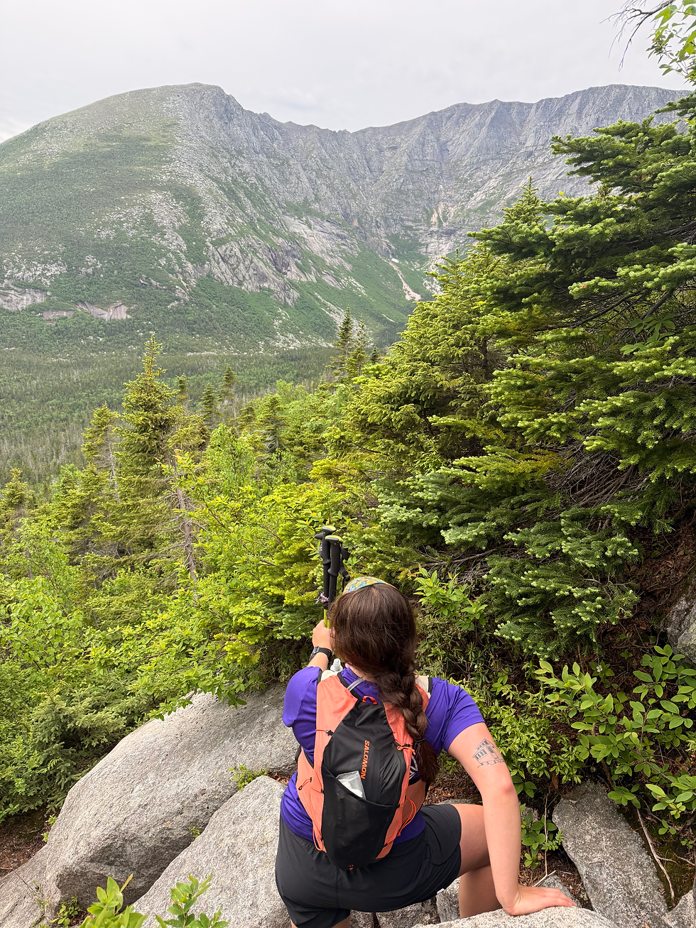
Immediately, we went off the beaten path that led to complete isolation, minus the summit crowd. Since I’d only done the Hurricane Mountain portion of the Hurricane trail (during a hurricane, too), we started on the vertical portion from the bridge to the start of Carriage Road. While Hurricane was snowy along the river, the first half of Carriage Road was free of snow.
As we climbed Carriage Road, a pleasant yet still relentless approach, the snow line settled in around 3700 feet. Because it is a backcountry ski route, the snow was bulletproof and perfect for ascending in microspikes. Foolishly, we started to think we could avoid snowshoes all day.

Once we hit South Peak, we cruised to the summit in the battering winds. Though we could barely hear each other over the wind, the summit had relatively open views, so we spent as long as we could up there. It was maybe 3 minutes…


After some brief human interaction, we headed down Beaver Brook and didn’t see anybody the rest of the day. The Beaver Brook section didn’t appear heavily tracked out, but the trough indicated it had been hiked somewhat frequently. Immediately, the blowdowns were considerable, and I think I only saw 2 blazes on our whole descent.
When we finally got to the Asquam Ridge junction, feeling slightly cocky that we’d maintained such a pleasant pace, it was immediately evident that only one person had been down in weeks. The snow was stable at first, but the afternoon sun and a stream running beneath the snow made for some jostling postholes.

We switched to snowshoes after a few close calls, yet miraculously continued to follow a bare boot track the whole way. At times, the prior tracks were 2-3 feet deep right into the stream beneath the snow. Even in the snowshoes, we still found ourselves sinking into the old post holes, punching through the water, and tripping over the dozens of blowdowns. At one point, the tip of my snowshoe went into a well, and I flew about 2 feet forward before landing back up on the trail. This was just the first of many falls I had the rest of the day!

By the time we got to Al Merrill, with one noted blue blaze, I thought we were in the clear, as I had done the rest of this trail before. What I didn’t know, though, was that the stream running under the earlier part was widening into a brook covered in extremely weak snowbridges. The going was slow, and the need for snowshoes coupled with the desperation to have them off was a battle.


As we got closer, I was beyond relieved to see all the bridges were still intact, as I simply would not have been able to rock hop the rushing rivers towards the bottom.
Once we got back to the road, the open stride couldn’t have felt better! By day's end, we completed 12 miles with 3,740 vertical gain. And with snowshoes on- it sure felt like that!
Now that I’ve done every route up Moosilauke, it also felt fitting to do a ranking- if anyone was interested.
Up Beaver Brook, down Benton
Glencliff, Benton, Tunnel Brook loop
Up Carriage, down Gorge Brook
Up Carriage, down Asquam
Seems I have a preference for the Clough-side of the mountain! Can’t go wrong with any of them, truly.


Congratulations on finishing the Moosilauke tab!