
Yosemite Valley to High Sierra Loop - September 2026

A few months back, Joe surprised me with a birthday trip to Yosemite. But not just any trip- a High Sierra backpacking loop. After many permit variations, we landed on 35 miles through Tenaya Canyon, up to Tenaya Lake, past Sunrise Lakes, and back to the valley on the John Muir Trail.
Save the details on our journey from Boston to San Francisco to the Valley; our trip truly started at Dimond O campground- a quiet national forest site a few moments from the Big Oak Flat Trailhead. Its address on Evergreen Road, as it turns out, was a ranch with several cows blocking the road. All donned with cowbells, we shared a few good laughs every time the jingles kept us from a much-needed sleep.
The sleep, which came and went poorly due to a rowdy neighbor and jet lag, was almost no matter, though. When we awoke on permit pick-up day, I could not have been more excited to enter the park for the first time. For anyone who's driven in before, the feeling can't be forgotten- but for anyone who hasn't, driving into Yosemite for the first time is unbelievable. What starts as a winding road through the trees quickly becomes a tunnel between massive cliff sides. And suddenly, Half Dome comes into view, sitting smugly waiting to be noticed on the last sweeping corner. Still caught up in the amazement of Half Dome and the massive granite walls lining the drive in, driving up to El Cap was even more unreal. Obviously, everyone knows it's a remarkable cliff. But seeing it in real life is not only awe-inspiring, but it also made me very angry with Alex Honnold.

For mid-September, the crowds were surprisingly thick; I couldn't be happier to be picking up a backcountry permit. Unsurprisingly, the Wilderness Center rangers were very kind and helpful. Their line of questioning, similar to the trail stewards I'm used to in New Hampshire, was polite but quickly uncovered misconceptions before sending people out. Thankfully, we passed the test: "Did you bring bear spray?" Which is illegal in the park, and they sent us on our way!
With heavy reorganization to fit the massive rented bear canisters into our packs, we set off on foot from Curry Village to the trailhead- Mirror Lake. The views were fantastic from the start. My only regret is that I wish we'd stayed on the access road a bit longer to break from the mosquitoes; they were in full force around Mirror "Lake!"

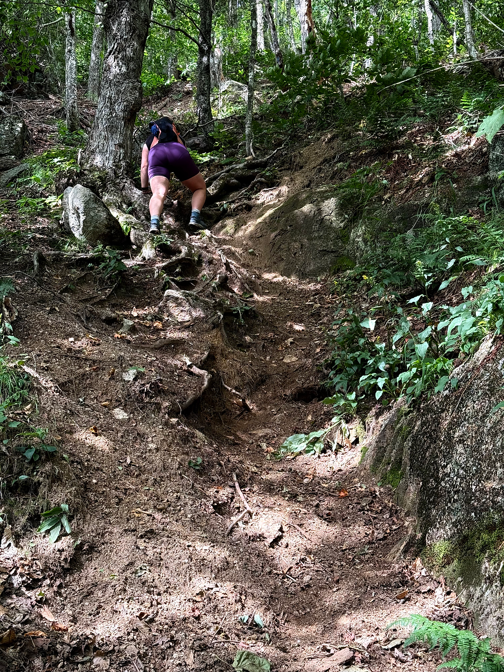
The first few miles were uneventful up until Tenaya Creek Bridge, where we filtered our last water for the climb. Our afternoon peace was thoroughly disturbed as we started up Snow Creek Trail- which boasted a self-counted 97 switchbacks.

Though the canyon walls were dramatically steep, the trail out of the Canyon was remarkable- complete with retaining walls and long swooping climbs. Looking at the slope angle map, I was expecting the trail to be much more frightening. But in proper Western style, this trail was ~almost~ good enough for livestock travel. Not quite, though- Snow Creek switchbacks are one of the 5 or so trails in the park rated "hiking only," so no horses here, folks. Our decision to count the switchbacks was well worth it and kept our hopes up through altitude conditions, dehydration, and a hot sun. Once the count climbed past 50 and we had a lot of wall to go, I dreaded hitting 100- because that would've sounded made up. 97, though, was precise. We told as many people the count as would listen.


Even after a liter of cold water and a proper snack break at the first Snow Creek crossing, the climb and other altitude ailments were really getting to me. I felt like I had a hole in my head, pounding worse with every step I took. As much as I wanted to go further than the high Snow Creek crossing, which was barely pumping water, it wasn't in the cards. Though the area was burnt and sloped, we found a decent spot just left of the crossing and took a well-deserved break before doing a single camp chore.

As we got ready for bed, it was really one thing after another for me. I got a series of dehydration/altitude nosebleeds throughout the trip, but nothing tapped me like the one at Snow Creek. By the time we actually fell asleep, I think I'd just about run out of the ability to sit up. Thank goodness Joe overpacked electrolytes; they saved me!
Miraculously, by morning and another liter of water down, I was fresh and ready to go. We were happy to leave the burnt section of forest for a lively one, but we had no idea what was in store for us past the Mt. Watkins cutoff. As soon as the trees cleared, it was obvious we'd missed out big time on the best campsite ever- the back overlook of Tenaya Canyon. From Clouds Rest all the way to the flat side of Half Dome, the views were unbelievable. We never would've known- but wow, this would have been the campsite of a lifetime!


After our admiration, we steadily traversed to Olmstead Point, a pleasant but dry granite trail section. The peace was eventually disrupted by the bustling Tenaya Lake, where we reorganized for the day. Though we nearly skipped the lake for crowds, I wish we'd stayed longer. While shallow at this time of year, the High Sierra views and clear water were unbelievable. As we passed on, all we could do was hope we'd have some swim potential up ahead.


Unlike the prior day, the climb to the "point of interest" was easy, but absolutely mobbed with day hikers and backpackers alike. The switchbacks made it hard to follow the normal right-of-way rules, but the stopping wasn't bad when there was always a view. Once we got to the Clouds Rest junction, the crowds thinned, and the rest of our afternoon was fairly easy through the first two Sunrise Lakes. By the lakes, we had decided to stop short of High Sierra Camp, but had no idea which Lake would be the best.
When our jaws dropped at Lower Sunrise, it was a foot drag to leave, but there were already several non-compliant camps set up along the water. Assuming the first lake would remain most popular, we set our sights on Middle. On arrival, we got the sense we could get far enough off trail to have the whole area to ourselves and took the chance.
As we trekked about a quarter-mile to the trail-opposite side of the lake, it seemed we had the whole area to ourselves until a group of 8 set up about 300 feet from us. Despite the proximity, we didn't even notice them overnight. It was freakishly silent at 9,500 feet- not even a squirrel could be heard.


After setting up our crown jewel camp, we enjoyed dinner/sunset on the sleeping pad, a refreshing swim in the frigid water, and several games of Uno- where Joe got destroyed. By nightfall, the Milky Way was demanding to be seen, and the stars were just unbelievable. It was tough to close my eyes on the stars, but the cold got me right in my quilt by 9 pm.

When we woke up to much cooler temps, we took our sweet time making lattes and oatmeal before our ascent to the High Sierra Camp. The climb wasn't bad, especially compared to the switchbacks that came before, but it's always hard to climb first thing. Finally at High Sierra Camp, we were pleasantly surprised to find a bathroom, no people, and a horse tie-up. Who's to say if camp would've even been busy, but we were plenty happy with our overnight decisions.

As we officially started down the John Muir Trail, it was remarkable how many times the terrain changed. Meadow to forest, to desert, to burn zone, to granite wonderland- the John Muir Trail refused to stay the same for more than 3 miles. As refreshing as the forest's shade was, we eventually traded massive, lively sequoias for a crisp, open burn zone. Although the aggressive sun and rough berry bushes were bothersome, the lack of trees awarded unbelievable views of Half Dome just ahead of us. Just when I'd thought we'd maxxed out on beauty over the trip, I kept being amazed.

Water was more frustrating to get to than anticipated through the Muir Burn, as the low and sharp growth kept me waiting for a "better" crossing. Once I was more than sunburned and parched, we crossed a tributary of Sunrise Creek just before the Clouds Rest intersection that had easy access. Tempting as it was to wait until the Merced River, my later bout of dehydration evidenced I should've filtered much more water.


When we walked past Clouds Rest and ventured closer to Little Yosemite Valley, the bear warning signs and stories increased drastically. Most notably, we heard about a woman getting charged by a bear at the campsite- stopping only 10 feet from her. Once we finally got down there, it was clear why the bears love LYV. Even though Little Yosemite is a "backpacker's" camp, it was crowded like the front country. On top of being 5 miles from the road, LYV is a very popular stopover for Half Dome. As a result, I would hardly consider our last night to be "backcountry."

Truthfully, I wish we'd just skipped over Little Yosemite in the moment, but by the next morning I felt a little less sure about that. Even though our night was more stressful (due to a surplus of bear shout-offs) than the others, I was shocked to see so many people on the trail before sunrise. I couldn't have imagined the hiker volume that trail sees midday.
Having hoped to miss some of the Half Dome hikers and all of the day hikers, we left camp at 5:45 am and saw a weekend stream of people. On the wide parts of the trail, it was no matter, but come the switchbacks, we played a lot of "who goes?" coming down.

With a few miles to go, we had an unexpected (I forgot what day it was; there were plenty of signs) but worthwhile reroute off Mist Trail and up the north side of Panorama Cliff. At first glance, I was devastated to have messed up the days and missed the 7 am cutoff for the trail maintenance. The switchbacks down from the detour looked STEEP, and I wasn't up for it on tired legs. Yet, as we looked from the top, the trail was paved.


Not paved in the way that I've historically called railbeds, but rock sealed with cement complete with retaining walls. I'd been on roads that were less stable than this trail! I was actually thankful our original route was closed- I found this section to be unforgettable. Towards the end, we ran into the sweetest lady who asked about our journey and joked that she loves Yosemite because "The trails aren't paved in Colorado!" I joked back, "We don't even have a switchback where we're from!"
The rest of the day was paved from there- more than necessary with all the foot traffic. I was also really impressed by the volunteer efforts around the park as we got into more crowded areas; it was great to see so many people extending their experiences and advice to hikers. We even met a wonderful woman with the Conservancy from Hanover, NH!
It was hard to believe I could put my backpack down by the time we popped out at the Happy Isles bus station- but I came around on the idea fast. Dust-covered and smiling, I could not have been more delighted with our trip around Yosemite. Joe and I couldn't help plotting our next adventure as the bus rolled toward the showers at Curry Village. There's a whole lot more Yosemite to see out there, and I intend to!
Stats:
35.55 miles
7,365 feet


Comments